
Even with meticulously planned trajectories, it’s possible that something goes wrong and an uncrewed vehicle veers off course, potentially endangering populated areas. Flight Termination Systems (FTS) are the critical systems designed to prevent such hazards. If the flight vehicle strays outside a predefined flight corridor, it will perform a self-destruct – typically in response to a command from a ground station. So knowing precisely where that vehicle is at all times is absolutely key to ensuring everyone’s safety.
Using Radar Tracking to Locate Vehicles
For decades, radar has been the primary method used for flight tracking. A radar can estimate the object's range and bearing by transmitting radio waves and measuring the time it takes for the echo to return. Multiple properly placed radar sites, typically four for flight testing, can work together to provide a 3D position.
Devices called transponders improve a vehicle's visibility and range on radar. These transmit a coded reply to the radar signal, significantly boosting the signal strength compared to passively reflecting radar signals. In addition to allowing for much greater detection ranges, they can provide extra data like altitude, giving a clearer picture of the vehicle's trajectory.
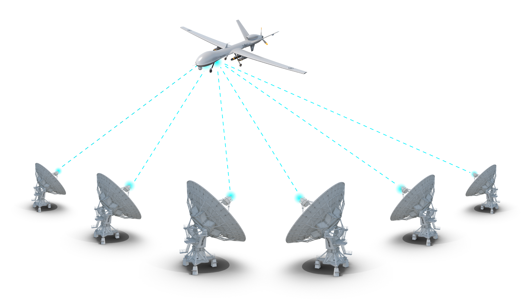
Figure 1: Multiple radar stations can track and aircraft’s position. Transponders further improve long-distance performance.
Challenges with Radar Installations
While effective, radar-based systems have some limitations:
- Costly Infrastructure and Operations: Radar sites are expensive to build, maintain, and operate. They require significant power, specialized personnel, and frequent calibration.
- Impractical for Long Distances: Some modern craft, particularly hypersonic vehicles, travel great distances during testing. Using radar systems means deploying and maintaining a continuous chain of sites, which becomes economically and logistically prohibitive.
Getting the Aircraft to Tell You Where It Is Instead
There is another approach – use a system onboard the craft to transmit real-time position information to a ground station. Everyone is familiar with Global Navigation Satellite Systems (GNSS), such as GPS, which can give you your approximate location. But the "approximate" part is a problem. Commercial GPS receivers have a positional accuracy that varies due to several factors, including:
- The number of simultaneous satellite systems tracked
- The location of the GPS antenna and multi-path effects on the test platform
- The type of GPS receiver used, e.g., multi-constellation and/or differential GPS (DGPS)
- Atmospheric uncertainty due to charged particles can introduce errors up to a few dozen meters
- Clock errors - even a few nanoseconds could mean a one-meter error
- The difference between the theoretical and actual satellite position
An unlucky combination of these errors could result in location data that is too inaccurate to be relied upon for flight termination. Additionally, GPS receivers do not provide orientation information, such as the platform's pitch, yaw, and roll, which provide useful flight test data.
Another solution is an inertial navigation system (INS). An INS uses an inertial measurement unit (IMU), which has sensors to measure changes in motion to work out where an object is compared to a known starting position. The USAF used these as far back as the 1950s. These IMUs weighed in at a then "light" 45 lb and would perform dead reckoning calculations based on initial latitude and longitude inputs.
Modern IMU variants are much more sophisticated and compact, but still essentially perform the same function. Vehicles can use them to derive velocities and spatial positions in 3D without additional external inputs. However, like GPS, IMU units have several sources of error, such as sensor drift, incorrectly viewing vibrations as motion, and errors resulting from incorrect installation. Since the IMUs calculate differences to a starting reference, the position error will worsen over time, forcing shorter flight tests or in-flight recalibrations.
The Solution: TSPI Systems
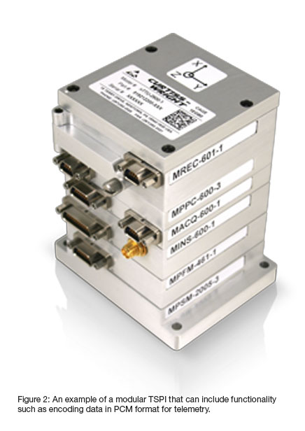
The solution is to make time-space-positioning information (TSPI) systems, which combine GPS receivers and IMU, along with other useful functions such as a transmitter. The GPS and IMU work together to better estimate the platform position and orientation data through data fusion/filtering techniques. A telemetry encoder and transmitter can then send this data to the ground. The advantages of this approach include:
- Cost-Effective: Lower setup and operational costs compared to traditional radar.
- Reduced Ground Infrastructure: Eliminates the need for extensive ground-based radar networks, especially over large geographical areas.
- Global Coverage: GNSS-based systems offer near-global coverage, making long-duration or flying in different locations more feasible. • Improved Accuracy: Modern TSPI systems provide precise position and orientation data.
TSPIs are not perfect, and there are some potential disadvantages, such as:
- Dependence on Onboard Systems: Relies entirely on the proper functioning of the vehicle's TSPI.
- Signal Vulnerability: GNSS signals can be jammed or spoofed, though robust FTS designs should incorporate countermeasures.
- Data Latency: While generally low, there can be slight delays in transmitting the data to ground control - usually a couple of hundred milliseconds at most.
A Stepping Stone to Autonomous FTSs
Another advantage of having a position system onboard is that it is a crucial stepping stone towards an autonomous FTS (AFTS). In an AFTS, the vehicle decides to terminate the flight if it detects that it is straying from a pre-programmed flight corridor. This further reduces costs as there is no longer a need for a dedicated ground station and crew. It will also reduce the time taken between an aircraft going off-course and being terminated. A few seconds may seem trivial, but consider a hypersonic vehicle travelling at Mach 6. That’s about 2,000 m/s, which is over 10 miles after only a few seconds.
Benefits and Next Steps
The shift from purely ground-based radar tracking to onboard position reporting for FTS offers significant benefits: reduced costs, expanded operational ranges, and the foundation for increasingly autonomous and responsive safety systems. The next steps for deploying TSPI systems for FTS are primarily centered around their certification and proven effectiveness in live trials. Curtiss-Wright believes these steps will happen very soon, and spaceflight and aerospace safety operations will only become more cost-effective and robust.

Subscribe Today!
Subscribe to our blog and receive a monthly email that keeps you up-to-date with the latest news and insights from Curtiss-Wright.

Ben Kupferschmidt
Sr. Manager, Desktop Software / Product Line Manager, Ground Solutions
Ben is based in Newtown, PA, and heads product management for the Aerospace Instrumentation software and ground station teams in Curtiss-Wright.
